Secretary of War Hegseth’s Maritime Domain Awareness Proposal for the South China Sea
Defense Secretary Pete Hegseth concluded his Indo-Pacific tour in early November 2025 with a key emphasis: “America First does not mean America Alone.” Speaking at the Association of Southeast Asian Nations (ASEAN) Defense Ministers’ Meeting in Kuala Lumpur on November 1, Hegseth also proposed a technological solution to one of the region’s most intractable problems, China’s maritime assertiveness in the South China Sea which suggested what he meant by this statement.
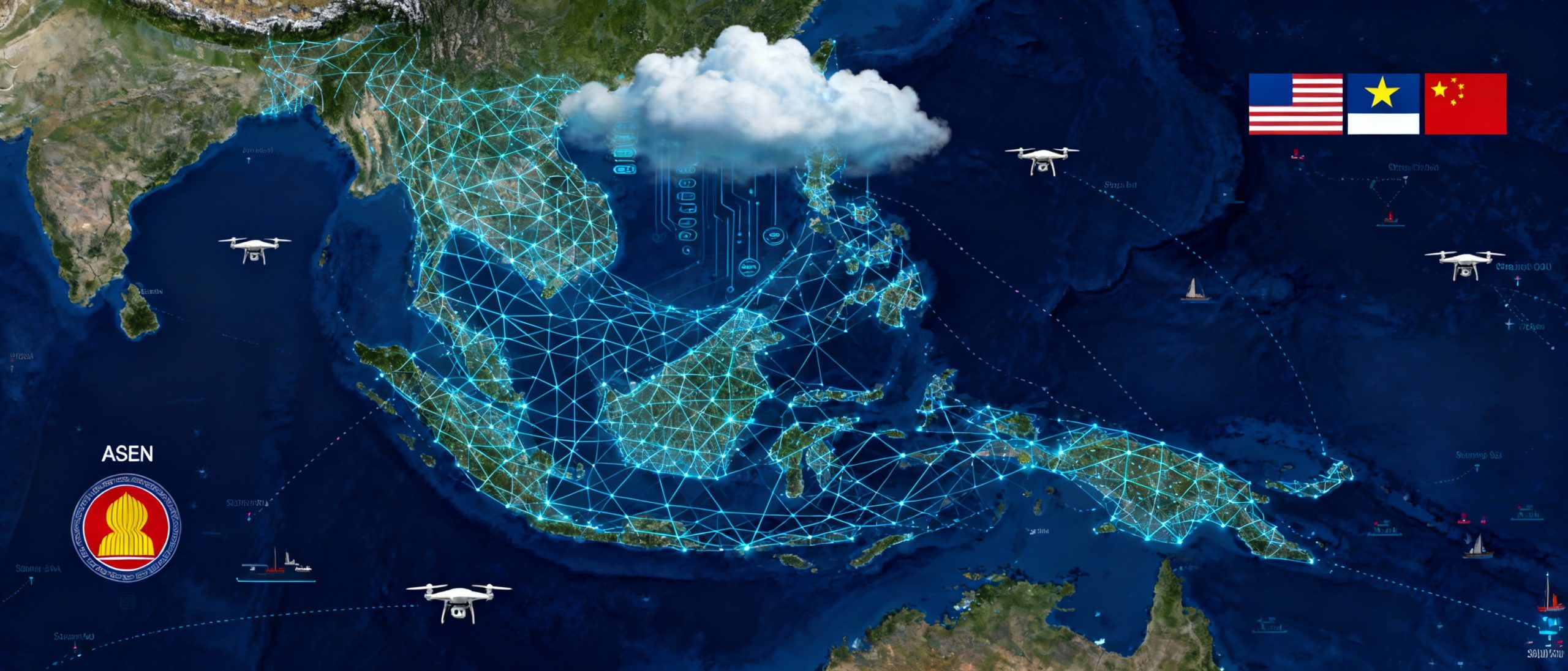
The centerpiece of Hegseth’s diplomatic offensive was a proposal to build a shared maritime domain awareness system leveraging unmanned aerial and undersea drones capable of real-time threat detection and coordinated response.
This wasn’t merely rhetorical flourish.
The proposal represented the potential exportation of a working operational model that the U.S. Navy has been refining in the Middle East since 2021, Task Force 59, to the contested waters where four ASEAN members face daily harassment from Chinese maritime forces.
The Strategic Context: A Fragmented Maritime Awareness Landscape
To understand the significance of Hegseth’s proposal, one must first appreciate the remarkably crowded and fragmented landscape of maritime domain awareness initiatives already operating or attempting to operate in the Indo-Pacific.
The region has become something of a laboratory for competing visions of maritime security cooperation, with mixed results.
The Quadrilateral Security Dialogue (Quad) announced its Indo-Pacific Partnership for Maritime Domain Awareness (IPMDA) in May 2022, aiming to share information at sea with partners via new technology to track “dark shipping,” “rendezvous at sea,” and climate and humanitarian events. The initiative integrated radio frequency and satellite data from HawkEye360’s satellites into a web-based SeaVision system developed by the U.S. Department of Transportation.
Yet more than three years later, as one analyst observed, “the QUAD-initiated IPMDA remains largely dormant due to diplomatic challenges surrounding the integration and de-confliction of diverse Maritime Domain Awareness systems.”
The European Union has not stood idle. Its CRIMARIO program, launched in 2015 for the Western Indian Ocean, extended coverage to the Indo-Pacific in 2020. At its center lies the IORIS platform, collecting data from Automatic Identification Systems (AIS) and Skylight AI, with potential to integrate Copernicus satellite data and radio frequency data. Several ASEAN countries, Indonesia, the Philippines, and Vietnam, have been invited to adopt IORIS. Canada has offered its Dark Vessel Detection Program, while India operates its Information Fusion Center-Indian Ocean Region.
The result is a patchwork of overlapping systems with significant interoperability challenges. The IORIS system has clear compatibility issues with IPMDA’s HawkEye360 satellites and unmanned aircraft systems integrated into SeaVision. For ASEAN nations this fragmentation creates a practical dilemma: which system to adopt, how to integrate multiple offerings, and how to avoid being perceived as choosing sides in great power competition.
One Indonesian perspective captures the political sensitivity: Indonesia defines “inclusive” international maritime order as including the People’s Republic of China in regional maritime security discussions, a definition that differs fundamentally from the Quad’s implicit exclusion of Beijing. This philosophical divide has real operational consequences, as ASEAN operates by consensus and several members remain wary of initiatives that might antagonize their largest trading partner.
The South China Sea Flashpoint
The urgency behind Hegseth’s proposal stems from the intensifying pattern of Chinese maritime coercion in the South China Sea. During the ASEAN meeting, Hegseth cited specific examples of what he characterized as destabilizing behavior. China’s recent declaration of Scarborough Shoal, forcibly seized from the Philippines in 2012, as a “nature reserve” drew particular scorn. “You don’t put platforms on nature reserves,” Hegseth observed, describing the move as “yet another attempt to coerce new and expanded territorial and maritime claims at your expense.”
The Philippines, as a key U.S. treaty ally, has experienced the brunt of Chinese maritime assertiveness. Philippine officials have publicly disclosed that the number of Chinese vessels around its waters in a single week, including navy, coast guard, and maritime militia, can run into the hundreds. These encounters have included water cannon attacks, vessel ramming, and the use of lasers to damage the eyes of Filipino sailors.
Vietnam, Malaysia, and Brunei all claim portions of the South China Sea that overlap with Beijing’s expansive “ten-dash line.”
Yet ASEAN has traditionally sought to balance caution about Chinese behavior with recognition of China’s status as the region’s largest trading partner and a critical economic relationship none can afford to jeopardize.
Into this complex environment, Hegseth proposed a technological solution designed to provide ASEAN members with enhanced situational awareness while remaining within the bounds of defensive capabilities. The question is whether unmanned systems can thread this political needle while providing genuine operational value.
The Task Force 59 Model: Operational Proof of Concept
What distinguishes Hegseth’s proposal from previous maritime domain awareness initiatives is that it builds on an operational model that has been tested, refined, and proven effective in a similarly challenging maritime environment. Task Force 59, established by U.S. Naval Forces Central Command in September 2021, has become the Navy’s laboratory for integrating unmanned systems and artificial intelligence into fleet operations.
Vice Admiral Brad Cooper, who commanded U.S. 5th Fleet and oversaw Task Force 59’s establishment, articulated its core mission with characteristic directness: “The bottom line on why we’re doing this is so that we can develop and integrate unmanned systems and AI as a means to do two things: One, enhance our maritime domain awareness, and two, increase deterrence.”
The 5th Fleet’s area of operations presented challenges remarkably analogous to those facing ASEAN members in the South China Sea. The region encompasses nearly 2.5 million square miles of water, including the Arabian Gulf, Gulf of Oman, Red Sea, and parts of the Indian Ocean, a vast expanse where traditional naval assets struggle to maintain persistent presence. The operational environment includes critical choke points, crowded shipping lanes, and adversaries employing asymmetric tactics including fast-attack craft, maritime militia, and unmanned systems.
Task Force 59’s solution was to create what Cooper termed a “digital ocean”, a mesh network of AI-enabled unmanned surface vessels carrying cameras that transmit images and data via the cloud, creating “every partner and every sensor collecting new data, adding it to an intelligent synthesis of around-the-clock inputs, encompassing thousands of images from seabed to space, from ships, unmanned systems, subsea sensors, satellites, buoys, and other persistent technologies.”
The results were impressive by any measure. Task Force 59 reached full operational capability just fifteen months after establishment, a timeline that included eleven bilateral maritime exercises, three major international exercises, and over 30,000 hours of safely operating unmanned surface vessels. By 2023, the task force aimed to control 100 unmanned vehicles, with operational authority distributed between the U.S. and regional partners.
Perhaps most significantly, the task force demonstrated that artificial intelligence could solve a problem that had previously required massive human effort. Human operators simply cannot pick out anomalous behavior in crowded waterways where hundreds of vessels operate simultaneously. But Task Force 59’s combination of unmanned systems, sensors, mesh networks, and AI-powered analytics proved capable of identifying suspicious behaviors and cueing manned ships to investigate.
The Technology Stack: From Theory to Reality
The unmanned systems that Hegseth proposed sharing with ASEAN represent a mature technology suite, not experimental prototypes.
Four primary categories of systems have been validated through Task Force 59’s operations.
Unmanned surface vehicles (USVs) operate on the sea surface, carrying sensor packages and can maintain station for extended periods without human crews. For example, MARTAC’s MANTAS and Devil Ray USVs showcased in Task Force 59 advanced autonomy, modular sensor integration, and robust endurance, operating alongside manned patrol craft and allied naval forces to enhance maritime domain awareness and threat detection. Their vessels demonstrated persistent presence at sea, real-time data collection, and coordinated swarming activities through onboard AI-driven decision-making and mesh networking capabilities, validating their utility for extended intelligence, surveillance, and reconnaissance (ISR) missions and kinetic operations such as remote weapons deployment.
Unmanned underwater vehicles (UUVs) operate beneath the surface, gathering oceanographic data, conducting anti-submarine warfare, and monitoring subsurface activity. These systems have become particularly important as submarine operations intensify in contested waters. The challenge is that “because of constraining factors such as the limited endurance and sensor range of unmanned vessels, as well as the challenges of relaying data, it will be challenging for U.S. unmanned vessels to operate in a denied environment.”
Unmanned aerial vehicles (UAVs) equipped with maritime sensors provide the critical overhead perspective, capable of covering large areas and providing targeting data for surface assets. Fixed and deployable sensor networks, including buoys and stationary platforms, round out the system by providing persistent monitoring of specific locations or maritime approaches.
The integration of these disparate systems into a coherent operational picture represents the true innovation. During International Maritime Exercise 2022, Task Force 59 brought together eighty unmanned systems from ten countries. Sensors from unmanned vessels located and identified different items placed in the water, relaying visual depictions to command centers where artificial intelligence processed the data without human intervention, determining whether human operators should investigate further.
The cost-effectiveness of this approach cannot be overstated. Analysis suggests the Navy could potentially deploy hundreds of unmanned systems for the cost of a single major crewed ship.
This economic reality makes the technology particularly attractive for ASEAN nations with limited defense budgets facing a numerically superior Chinese maritime presence.
The Contractor-Owned, Contractor-Operated Innovation
One of Task Force 59’s most significant innovations and potentially its most exportable is the contractor-owned, contractor-operated (COCO) business model it pioneered. This approach fundamentally disrupts traditional defense procurement cycles in ways that make rapid technology adoption feasible for resource-constrained partners.
Task Force 59 introduced new unmanned systems in a matter of months using this COCO model, where Navy oversight is paired with commercial ownership and operation. This offers flexibility in assessing new innovations under realistic conditions, provides immediate feedback to vendors, and weeds out systems that fail to meet operational requirements. A traditional multiyear procurement and test cycle would not keep pace with the fluid nature of current technology advances.
Critically, the model also bolsters U.S. allies. Because new unmanned technologies are commercially available today, regional partners can procure the systems at speed without navigating complex foreign military sales processes or waiting for congressional approval. This democratization of advanced maritime surveillance technology potentially levels the playing field in ways that traditional platforms cannot.
For ASEAN members watching Chinese vessels swarm around contested features, the ability to rapidly deploy commercially available unmanned systems that integrate into a shared awareness network offers a tangible response capability without the political complications of accepting permanent U.S. military basing or forging explicit military alliances.
Distributed Lethality Meets Information Dominance
Hegseth’s unmanned systems proposal represents more than a technological fix to a tactical problem. It embodies a fundamental shift in how maritime power might be conceived and exercised in contested regions where traditional platform-centric approaches prove inadequate.
The distributed sensor approach Hegseth outlined where “threats to one are known by all” creates the potential for genuine collective defense without requiring the deep military integration that many ASEAN members find politically problematic. A Philippine Coast Guard cutter encountering Chinese maritime militia vessels could immediately share real-time data with Vietnamese, Malaysian, and Bruneian counterparts, who could in turn position their assets or alert their command structures. This creates complexity for potential aggressors while providing earlier warning and response options for defenders.
The economic dimension deserves emphasis. Traditional maritime security in the South China Sea has been conceived in terms of frigates, corvettes, and patrol vessels. platforms that cost tens or hundreds of millions of dollars and require years to build. The Philippines, despite being a U.S. treaty ally facing daily Chinese harassment, operates a coast guard and navy of modest capabilities. Vietnam’s maritime forces, while more substantial, are stretched thin across a long coastline and extensive maritime claims. Malaysia and Brunei face similar resource constraints.
Unmanned systems fundamentally alter this calculus. As demonstrated in Task Force 59, hundreds of persistent sensors can be deployed for the cost of a single major surface combatant. These systems don’t replace traditional platforms; rather, they multiply their effectiveness by dramatically expanding their surveillance envelope and providing cueing for limited high-value assets.
The operational concept also aligns with emerging American defense concepts around “mosaic warfare” and distributed operations. Rather than concentrating capability in a small number of exquisite platforms that present attractive targets, the approach distributes sensing and decision-making across many less-valuable nodes. Destroying or spoofing individual sensors doesn’t collapse the system; it simply creates gaps that other nodes fill.
Despite challenges, several factors suggest Hegseth’s proposal may spark interest in the region.
First, it offers something previous maritime domain awareness proposals have not: an operational track record. Task Force 59 is not a PowerPoint presentation or a joint statement; it represents over 30,000 hours of real-world operations proving that the technology works and that diverse partners can effectively integrate their systems. ASEAN defense planners can visit Bahrain, observe the operations center, and see the mesh network in action rather than relying on promises of future capability.
Second, the contractor-owned, contractor-operated model removes procurement obstacles that have delayed previous cooperation. ASEAN members can acquire commercially available systems without navigating foreign military sales, without requiring their parliaments to approve large defense expenditures, and without the political visibility of major weapons purchases from the United States. The model’s flexibility allows countries to scale their participation according to their resources and political comfort levels.
Third, the timing may be opportune. China’s declaration of Scarborough Shoal as a nature reserve while simultaneously building military platforms on the feature demonstrated Beijing’s contempt for legal niceties and regional sensibilities.[51] The cumulative effect of Chinese water cannon attacks, vessel ramming, and intimidation of civilian fishermen has created a constituency within ASEAN for more robust maritime security cooperation, even among traditionally cautious members.
Fourth, the COVID-19 pandemic and subsequent economic disruptions have reinforced ASEAN members’ awareness of their maritime dependencies. The South China Sea carries roughly one-third of global maritime trade. Any disruption to freedom of navigation threatens the economic lifelines of every ASEAN member. Enhanced maritime domain awareness serves not just narrow security interests but broader economic security.
Unmanned Systems as Strategic Equalizer
Defense Secretary Hegseth’s proposal to share unmanned maritime surveillance technology with ASEAN represents a potentially significant strategic initiative, though one whose success remains uncertain. By offering to export the Task Force 59 model to the South China Sea, the Trump administration has put forward a concrete program that addresses real operational gaps while building on proven technology and established operational concepts.
The unmanned systems approach offers several advantages over traditional maritime security cooperation. It is economically accessible to resource-constrained partners. It is operationally validated through years of Task Force 59 operations. It provides genuine capability enhancement without requiring the deep military integration or forward basing that many ASEAN members find politically unacceptable. And it offers a potential counter to China’s numerical superiority in maritime forces by multiplying the effectiveness of existing ASEAN assets through persistent surveillance and shared awareness.
Yet significant obstacles remain. Political sensitivities about appearing to join an American-led containment strategy. Technical challenges around system integration and interoperability. Questions about data sovereignty and intelligence sharing. And the fundamental tension between ASEAN’s consensus-based decision-making and the reality that different members face vastly different levels of Chinese pressure.
The ultimate test will be whether ASEAN members conclude that enhanced maritime domain awareness serves their interests enough to justify the political costs that China will certainly impose. The answer to that question will determine whether Hegseth’s unmanned systems proposal becomes a model for collective maritime security or joins the growing list of well-intentioned initiatives that founder on the shoals of Southeast Asian political complexity.
What seems clear is that the era of traditional platform-centric maritime security in the South China Sea is giving way to something new, a domain where persistent unmanned sensors, artificial intelligence-enabled analytics, and distributed networks compete for information dominance.
The question is not whether unmanned systems will shape the future of maritime security in the Indo-Pacific, but rather whose systems will dominate and whose partners will benefit from the resulting awareness. Hegseth’s November proposal sought to answer that question decisively in favor of ASEAN members and American interests. Whether the region’s maritime powers accept the offer remains to be seen.
The featured graphic was created by an AI program.
A Paradigm Shift in Maritime Operations: Autonomous Systems and Their Impact